What Agricultural UAV Applications Bring to Crop Monitoring
Agricultural UAV applications have fundamentally reshaped how farmers and agri-businesses monitor crop health, manage field inputs, and respond to emerging threats. By deploying unmanned aerial vehicles equipped with multispectral sensors, RTK positioning modules, and AI-powered software platforms, growers gain sub-meter visibility across entire fields in a single flight. Compared to traditional ground scouting, drone-based crop monitoring cuts labor hours significantly while delivering actionable data on plant stress, soil moisture, and pest pressure—making agricultural UAV applications one of the most impactful investments in modern precision farming today.
Understanding Agricultural UAV Applications in Crop Monitoring
What Makes UAV Technology a Game-Changer for Farms
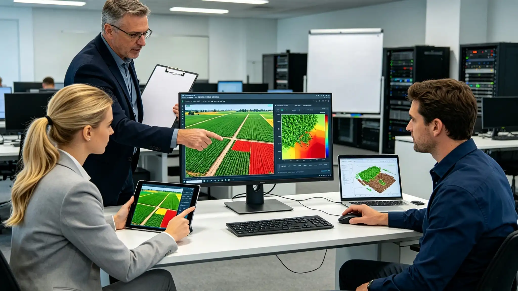
Precision farming needs up-to-date, detailed information, and old ways of doing things can't keep up. When a trained botanist walks through a 500-acre corn field, they don't see any obvious signs of stress until the yield potential has already been lowered. Agricultural UAV applications fill in that blank by getting thermal signatures, high-resolution overhead images, and NDVI maps in a single 30-minute or less automatic trip. A study released in the journal Remote Sensing in 2022 found that nitrogen deficiency could be found up to 14 days faster with drone-based NDVI mapping than with visual scouting. This gave farms a clear edge when making decisions.
The main tools that made these findings possible are:
- Multispectral sensors that measure reflected light in the visible and near-infrared ranges. These sensors produce NDVI and NDRE indices for mapping crop stress with very high spatial resolution.
- Thermal imaging cameras can find problems with irrigation, early disease hotspots, and differences in soil temperature that RGB images alone can't find in regular field surveys.
- RTK positioning units provide GPS accuracy down to the centimeter level, making sure that repeat flights line up perfectly so managers can consistently track changes in the canopy over multiple growth stages.
With these hardware features and cloud-based farm management platforms, recommendations can be made from raw aerial data within hours of each flight mission.

How UAVs Revolutionize Crop Monitoring: From Soil to Harvest
The Shift From Manual Scouting to Data-Driven Field Intelligence
In the past, crops were monitored by walking transects by hand, randomly sampling soil, and using low-resolution satellite images that were updated every 5–16 days. Each method has its own weak spots. When you scout by hand, you can only see about 10% of a typical large farm every day, because satellite data is limited by cloud cover and revisit intervals. Agricultural UAV applications replace these separate methods with a single, reusable workflow.
The monitoring cycle that is made possible by UAVs works in three clear steps. Autonomous flight along pre-programmed routes at steady altitudes takes pictures that meet and are then turned into georeferenced orthomosaics for data collection. The next step is real-time analysis, where AI-powered software like DJI SmartFarm or Pix4Dfields separate plant indices, mark areas that don't seem normal, and put prescription maps on top of them. Reporting that can be used ends the loop by sending variable-rate application suggestions straight to field equipment. This way, inputs only go to the areas that need them the most.
According to the Journal of Field Robotics (2021), farms that use drone-based tracking programs have seen their input costs drop by 15–30% and their yields rise because they started intervening earlier.
Key Agricultural UAV Applications Enhancing Crop Monitoring
From Pest Detection to Precision Spraying—Core Use Cases
Insect detection and precise spraying are two of the most common uses. One of the main reasons why UAV use is growing so quickly around the world is that they can be used for a wide range of tasks, from inspecting crops to other tasks. Each use case deals with a different operating problem that old methods don't do well.
Multispectral crop health tracking helps agronomists find problems like a lack of nutrients, weather stress, and fungal infections early on in the growth process, before they become noticeable. Soil moisture mapping made from thermal data helps with adaptive irrigation scheduling, which can cut the amount of water used by vegetable crops that are drip-irrigated by up to 40%. Using high-resolution RGB imagery to find pests and diseases early on lets you take targeted action before populations spread across a field.
Agricultural UAVs can be used for more than just scouting. They can also be used to actively protect plants. Pesticides are only used when variable-rate spraying drones with centrifugal atomization nozzles detect high pest pressure. This lowers chemical loads while saving useful insect populations. Precision planting systems spread cover crop seed and powdered fertilizer more evenly than 95% of the time, making them better than broadcast spreaders for uneven ground.
UAVs can also be used to keep an eye on mixed farming operations. Thermal cameras can quickly and easily find animals in large pastures, which saves time and effort on properties with a lot of grazing.
Selecting the Right Agricultural UAV for Effective Crop Monitoring
Matching Platform Specifications to Farm-Scale Requirements
The whole tracking program is affected by the choice between fixed-wing and multi-rotor systems. Fixed-wing UAVs can cover more than 400 acres per charge, which makes them a cost-effective choice for large grain operations that care more about speed than accuracy. Multi-rotor platforms are the best choice for plant protection tasks because they can hang steadily, follow exact waypoints, and work with both spraying and spreading payloads. This makes them the best choice for mixed crop operations and paddy fields.
Before deciding on a platform, procurement teams should look at four important groups of specifications:
- The amount of land that can be sprayed directly depends on the payload capacity and tank volume of the commercial models on the market today. These range from 10L to 70L.
- Heavy-lift spray drones can usually fly for 10 to 20 minutes at full speed, which affects how many ground support staff and battery sets are needed per shift.
- Compatibility and integration of sensors, because platforms that can accept different multispectral, RGB, and thermal packages will be more valuable in the long run than designs that use set sensors.
- Integration of farm management software, making sure that flight logs, spray records, and NDVI results go straight into current agronomic decision tools without having to be transferred by hand.
DJI, Yamaha, and XAG all make leading systems, but each has its own strengths when it comes to build quality, after-sales support, and legal acceptance in key export markets. By matching the platform's specs to its actual operational scale, you can avoid over-investment and get the most out of the first two seasons of deployment.
Overcoming Challenges in UAV-Based Crop Monitoring
Addressing Regulatory, Technical, and Workforce Barriers Directly
The biggest problem we hear from procurement managers isn't doubts about technology, but how ready the workforce is. A good drone platform that is stored in a shed because there isn't a qualified pilot available is a waste of money and not a good investment. In the US (FAA Part 107) and across the EU, operators must have valid certificates before they can fly commercial UAVs. This creates a real skills gap that businesses need to plan for ahead of time.
Programs also get stuck when there are technical problems with handling data. Orthomosaic rendering and multispectral index calculation need to be done quickly and easily with software, which most farm workers don't have access to without formal training. For institutional buyers in charge of government-funded projects, choosing scalable platforms with easy-to-use interfaces and investing in operator certification programs from the start makes program continuity and audit readiness a lot better.
Privacy laws that allow low-altitude aerial spying over nearby properties make cooperation more difficult, especially in areas with a lot of farms. Working with experienced training companies that teach both technical skills and regulatory knowledge makes sure that qualified operators know from the start what their legal responsibilities are and how to carry out flights safely.
Conclusion
Agricultural UAV applications are no longer just test tools for technology pilots; they are now essential for competitive farming and evidence-based agronomy. Multispectral crop health mapping and variable-rate precision spraying are two ways that drone technology improves the efficiency of inputs, the ability to intervene early, and the openness of farm management. Today, the problem is not having enough tools, but not having enough trained workers. When businesses spend money on structured, certification-based operator training, they build the practical foundation they need to get the most out of these platforms throughout every growth season.
FAQ
1. How do agricultural UAV applications improve crop monitoring accuracy?
Drones use AI analytics and multispectral imaging to find crop stress, nutrient deficiency, and pest pressure much earlier than people on the ground. The NDVI and NDRE indices that are made from each flight create georeferenced maps that show differences across an area with a resolution of less than 5 centimeters per pixel. This lets managers make choices based on spatial data instead of guesswork based on samples.
2. What sensors are most commonly used on crop monitoring drones?
Most of the time, three types of sensors are used: RGB cameras to look at the canopy, multispectral sensors that record five to ten spectral bands to figure out the plant index, and thermal cameras that look for signs of moisture stress and watering problems. Professional-grade systems now come with RTK modules that make it possible to repeat positions over time, which is needed for time-series crop change research.
3. Are there legal requirements for operating agricultural drones in the US?
Yes. FAA Part 107 rules say that people who want to use UAVs for business purposes in the US must pass a test to get a Remote Pilot Certificate. Extra waivers are needed for operations over people, at nite, or beyond the line of sight. Government-funded training programs should be run by organizations that make sure all enrolled students follow certification paths that are in line with current FAA rules.
4. Can beginners operate plant protection UAVs after structured training?
Of course. The agricultural UAV applications course at ECR Academy starts with the basics of platform architecture and moves on to simulations, supervised flights, and planning missions in the field. The organized curriculum makes sure that students who have never used a UAV before can become proficient in using them and ready for licensing by the end of the program.
Partner With E.C.R Academy — Your Agricultural UAV Applications Training Supplier
E.C.R Academy offers training in agricultural UAV applications that is in line with the needs of the industry. The training is based on real-life field situations and includes qualified instructors and a full-process simulation-to-field equipment platform. Businesses, agricultural institutions, and government training programs that need certified, job-ready operators can use our project-based curriculum. You can email our expert team at ecr2008@enteredu.com or visit enteredu.com to learn more about partnership models, licensing of curriculum, and customized delivery options that fit your company's purchasing cycle and training goals.
References
1. Remote Sensing — Ballesteros, R. et al. (2022). Multispectral UAV-Based Crop Monitoring for Early Detection of Nutrient Deficiencies in Maize.
2. Journal of Field Robotics — Berni, J.A.J. et al. (2021). Thermal and Narrowband Multispectral Remote Sensing for Vegetation Monitoring From an Unmanned Aerial Vehicle.
3. Computers and Electronics in Agriculture — Zhang, C. & Kovacs, J.M. (2020). The Application of Small Unmanned Aerial Systems for Precision Agriculture: A Review.
4. Precision Agriculture — Sankaran, S. et al. (2021). Low-Altitude, High-Resolution Aerial Imaging Systems for Row and Field Crop Phenotyping.
5. Biosystems Engineering — Mogili, U.R. & Deepak, B.B.V.L. (2018). Review on Application of Drone Systems in Precision Agriculture.
6. International Journal of Remote Sensing — Tsouros, D.C., Bibi, S. & Sarigiannidis, P.G. (2019). A Review on UAV-Based Applications for Precision Agriculture.
_1781601799781.webp)