UAV Applications Technology: From Aircraft to Industry Tool
Unmanned aerial vehicles have shifted from hobbyist gadgets to precision industrial instruments in less than a decade. UAV applications technology sits at the intersection of aeronautics, autonomous control, sensor fusion, and high-speed data transmission — enabling complex missions without an on-board pilot. Across sectors such as power line inspection, geospatial surveying, agricultural spraying, and emergency response, this technology eliminates three persistent pain points: high operational risk in hazardous environments, the prohibitive cost of manned aviation, and the chronic inefficiency of manual large-scale monitoring. The result is a data-driven, aerial-perspective transformation of traditional workflows.
What UAV Applications Technology Actually Does in the Field
The Hardware and Intelligence Behind Every Flight
Modern unmanned aerial systems are based on three types of airframes: fixed-wing platforms that are best for long-range coverage, rotary-wing multicopters that are great at hovering precisely, and hybrid VTOL designs that take the best features of both types. The sensor stack that each category has is what makes it useful in industry. RTK/PPK positioning devices provide geographic precision down to the centimeter level. LiDAR units make thick 3D point clouds over land that can't be surveyed on the ground. Radiometric thermal cameras can find hotspots on live transmission towers for high voltage power lines without having to cut the line.
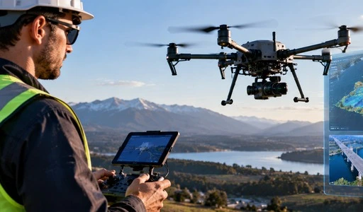
New developments in AI-driven flight controls, solid-state battery chemistry, and mmWave obstacle-avoidance radar have made it possible for aircraft to stay in use longer and in all kinds of weather. Industrial-grade systems now usually meet IP45–IP67 ratings for ingress protection and can handle sustained winds up to Beaufort Scale 6–7 (≈15 m/s) while keeping sub-decimeter accuracy—specs that are very important on a real jobsite.
Where Industries Deploy These Capabilities
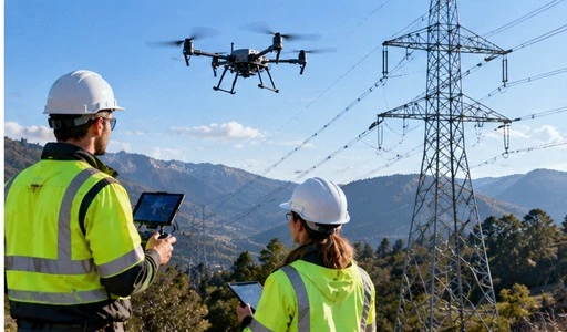
It's helpful to look at how widely release is used. When used with traditional ground equipment, variable-rate spraying drones in precision agriculture can cut the amount of chemicals used by up to 30%. When used in construction, oblique photogrammetry UAVs can make Digital Surface Models of busy job sites in hours instead of weeks. In power utilities, thermally equipped rotary-wing platforms check transmission corridors that would have to be inspected by expensive helicopter charters or dangerous climbs by hand otherwise. Emergency management groups use UAVs with both visible and infrared light for search-and-rescue operations at nite in areas where GPS signals are weak after a disaster.
One thing all of these deployments have in common is that they need users who can do a lot more than just move a remote controller. They need technicians who know how to tune flight control parameters, integrate mission payloads, plan routes logically, and follow regulations. These are all skills that can only be reliably learned through structured training.
How UAV Technology Solves Industry Challenges?
From Manual Bottlenecks to Scalable Data Collection
In the past, inspecting infrastructure meant sending people up into towers, onto rooftops, or up into cliffs. This was slow, expensive, and statistically dangerous. MarketsandMarkets estimated that the commercial drone market was worth USD 26.8 billion in 2023 and predicted that it would grow at a rate of more than 16% per year until 2028. This was mainly due to the difference in productivity between manned and unmanned methods.
Workflows that use UAV applications technology immediately fill this gap. A utility company that used rotary-wing inspection drones said that the time it took to check each tower went from four hours to less than twenty minutes. At the same time, thermal imaging made it easier to find problems. Agricultural groups that used self-driving spraying platforms saw a 40% drop in the number of hours of field work needed during busy application times. These aren't small improvements; they change the way things are done.
In none of these cases is hardware by itself what makes them possible. The only people who can put together, calibrate, and run the system are qualified professionals. They can also interpret the data it collects and keep it in good shape between deployments. This is where the lack of skilled workers becomes a strategic problem for businesses that want to grow their drone operations.
Comparing UAV Technologies for Different Industrial Needs
Matching Airframe and Payload to Your Operational Scenario
A question that procurement teams often ask that seems very simple but isn't: "Which system fits our use case?" The answer is based on four factors that work together: flight duration, cargo capability, sensor compatibility, and the type of airspace regulation. In real life, these are how the main configurations compare:
- Fixed-wing platforms can carry between 1 and 5 kg of cargo and can fly for 60 to 120 minutes on a single charge. They are good for mapping long corridors, surveying pipeline right-of-ways, and keeping an eye on the environment along the coast where coverage distance is more important than hover accuracy. Their weakness is that they need a runway or rocket launch, which makes them hard to use in crowded or urban areas.
- Rotary-wing multicopters can usually carry loads of 2 to 15 kg and can fly for 25 to 45 minutes on a single charge. Because they can take off and land vertically, they are the best choice for tower inspection, precise spraying, construction site documentation, and taking pictures from above in cities. In exchange, the range per flying period is less.
- Hybrid VTOL systems blend vertical takeoff and fixed-wing cruise economy, and with modular cargo bays, they can fly for more than 90 minutes. They are still more expensive to buy, but they are becoming more popular for emergency logistics and cross-country inspection routes.
When you choose the wrong model for a mission, you end up with multiple battery swaps, limited data coverage, and payloads that don't work with the plane. A core principle of buying is matching capacity to need from the start.
Leading UAV Technology Providers and Market Trends in 2026
The Market Forces Shaping Vendor Selection
The world market for UAV applications technology supplies has grown up a lot. DJI Enterprise is still the best rotary-wing provider for commercial mapping and inspection tasks. AgEagle and senseFly (now part of Esri's partner ecosystem) are the best fixed-wing geospatial applications. New American makers are making progress in defense-related consumer markets. This is because they have to follow the NDAA in order to get government contracts.
Three structural trends are changing how vendors are judged. Using AI and machine learning together now lets defects be automatically classified while in flight, which cuts the work that needs to be done after the inspection by up to 60% in some programs. With modular payload designs, one airframe can quickly switch between LiDAR, multispectral, and heat sensors, which increases the return on investment (ROI) per unit. Through the Payload SDK, Onboard SDK, and Mobile SDK frameworks, being able to communicate with IoT infrastructure and GIS enterprise platforms is no longer a nice-to-have feature but a basic expectation.
For procurement workers, choosing a provider depends more and more on the quality of their after-sales support, training infrastructure, and help with regulatory compliance. This is especially true as the FAA's Remote ID mandate and Part 107 waivers continue to change.
Procurement Best Practices and Guidelines for UAV Systems
Building a Scalable, Compliant Drone Fleet
When you buy UAV systems without an organized buying framework, you often end up with gear that isn't being used, compliance risks, and skill gaps in your workforce. These risks are greatly reduced by a disciplined purchase method.
Before you talk to vendors, break down your operational needs into groups. The payload, airspace, and maintenance needs of an agricultural spraying operation are very different from those of a construction survey team or a utility inspection unit. Before you look at platforms, you should define mission types, yearly flight-hour goals, and data output needs.
Carefully look over the buying structures. Ready-to-fly packages make setup easier and release faster, but they don't let you change much about them. While modular kits allow for flexible payloads, they take longer to put together. Leasing models lower the cost of cash and can include upkeep contracts, which makes them appealing to businesses that want to grow without committing to full control.
From the start, add UAV data outputs to your existing business software. If your drone can send sensors and geospatial data directly to your GIS or ERP platform, it is much more useful than a system that stores data in separate silos and needs to be transferred by hand.
Give more weight to sellers who offer approved operator training along with their tools. According to the FAA, there were more than 800,000 registered drone operators in the US in 2024. However, there are still not many qualified industrial-grade technicians who can do full-system maintenance. Buying tools and following organized certification paths together will protect your business's ability to keep running.
Conclusion
UAV applications technology is no longer just a novelty; it is now an important part of industrial infrastructure. Companies that see drone skills as a skill that their employees need to have, not just something they can buy, will be successful in this area. The unique selling point is qualified operators who have been certified through organized training that is based on real-life situations in the business. If your company wants to grow its multi-sector service capacity, build a vocational UAV curriculum, or increase the number of drones it uses for inspections, the best way to get there is through certified, hands-on technical education. The tech is all set to go. The question is whether or not your team is.
FAQ
1. Can someone with no technical background enroll in a UAV application technology program?
Yes. A well-organized program starts with basic subjects like mechanical drafting, flight rules, and electrical and electronic technology. Later, it moves on to more complex subjects like advanced flight control and mission payload integration. Knowing basic science and having a practical mind can help you learn faster, but you don't need to have experience with flying before.
2. What certifications can graduates pursue after completing UAV training?
In the US, graduates often go after FAA Part 107 Remote Pilot certification along with manufacturer-specific endorsements for industrial platforms. Learners can get ready for jobs like UAV pilot, assembly and maintenance technician, aerial survey data processing specialist, and inspection operations technician through programs that are in line with industry technical standards.
3. How do teaching tools help people learn skills through doing?
Integrated training settings have both modeling flight software for practicing safe scenarios and real industrial-grade UAVs for putting them together, fixing bugs, and flying them in the field. The four-platform closed-loop model includes a flight training lab, an assembly and debugging lab, a simulation lab, and an inspection and maintenance lab. This model makes sure that students learn every part of the operating process before they go out into the field.
Partner with E.C.R Academy to Build Your UAV Workforce
Since 2010, E.C.R. Academy has helped over 300,000 students get qualified and helped nearly 500,000 students in 28 countries. In our UAV applications technology training program, business engineers work with academic experts on a project-based curriculum that meets the technical standards of the industry. Anyone looking for a UAV applications technology supplier for structured workforce development is welcome to get in touch, whether they are a business, a vocational school, or an industry group. Visit enteredu.com or email us at ecr2008@enteredu.com to talk about a custom relationship.
References
1. MarketsandMarkets. Commercial Drone Market — Global Forecast to 2028. 2023.
2. Federal Aviation Administration. FAA Aerospace Forecast: Fiscal Years 2024–2044. 2024.
3. AUVSI (Association for Unmanned Vehicle Systems International). The Economic Impact of Unmanned Aircraft Systems Integration in the United States. 2023.
4. ASTM International. ASTM F3322-18: Standard Specification for Small Unmanned Aircraft System (sUAS) Parachute Systems. 2018.
5. Watts, A. C., Ambrosia, V. G., & Hinkley, E. A. "Unmanned Aircraft Systems in Remote Sensing and Scientific Research." Remote Sensing, 2012.
6. Pajares, G. "Overview and Current Status of Remote Sensing Applications Based on Unmanned Aerial Vehicles." Photogrammetric Engineering & Remote Sensing, 2015.


_1781601799781.webp)