UAV Applications Technology Across Agriculture, Mapping and Inspection
UAV applications technology has fundamentally reshaped how industries collect data, monitor assets, and execute field operations. By integrating autonomous flight systems, high-resolution sensors, and real-time data transmission, unmanned aerial vehicles now serve as indispensable tools across agriculture, geospatial mapping, and infrastructure inspection. Organizations that invest in structured drone pilot training and certified technical education gain a measurable competitive edge — reducing operational costs, improving data accuracy, and scaling their workforce with industry-ready professionals.
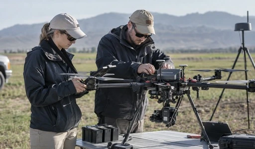
Understanding UAV Applications Technology in Agriculture, Mapping, and Inspection
What Makes UAV Systems Transformative Across Industries?
The three main parts of a modern unmanned aerial system are the airframe and power unit, the onboard flight center with RTK/PPK guidance for placement down to the centimetre level, and mission-specific packages such as LiDAR, heat sensors, or multispectral cameras. Standard methods have had three problems for a long time: dangerous human checks, the high cost of manned flight, and slow, hard-to-do data collection over big areas. These parts fix all three of them at once.
In areas like farming, tracking, and checking power lines, drones have taken over tasks that used to require days of work by people on the ground. The Federal Aviation Administration thinks that there will be more than 850,000 business drones registered in the US by 2025. This shows how quickly the business world is embracing robots in the air. These trends tell people in charge of buying things and making decisions at institutions that they need to start hiring qualified experts right away, not just buy tools.
UAV Technology Applications in Agriculture: Precision Farming and Beyond
Crop Monitoring, Soil Analysis, and Spray Operations
For a long time, precise farming has been one area where drones have been used. Agronomists can use multispectral image systems on agricultural UAVs to find areas where crops are stressed, problems with watering, and early stages of pest outbreaks weeks before the pests show any obvious signs. NDVI (Normalised Difference Vegetation Index) maps are made by these systems. It is possible to look at evapotranspiration and soil moisture profiles over large farming areas with the help of thermal monitors.
An American Society of Agricultural and Biological Engineers report from the field shows that a single fixed-wing agricultural drone can survey up to 200 hectares per flight. Multi-rotor spray drones can apply targeted inputs at variable rates, which can reduce the need for chemicals by up to 30% compared to traditional ground equipment. For businesses, these numbers can be easily turned into ROI metrics that help them choose what to buy.
Any business or trade school that wants to start a farming drone program needs to have more than just piloting skills. Operators need to learn how to handle mission payloads, plan routes, and process agricultural data in the real world. The UAV applications technology program at ECR Academy gives students all of these skills through a project-based curriculum.
UAV Applications for Mapping and Surveying: Enhancing Accuracy and Speed
Fixed-Wing vs. Multi-Rotor: Choosing the Right Platform
When it comes to cost, UAV-based photogrammetry and LiDAR scans are always seen as the best ways to create high-density 3D point clouds, Digital Elevation Models (DEMs), and orthomosaic maps. Aerial mapping with drones can cut field time by up to 70% compared to traditional land surveying, and when RTK positioning modules are used, the accuracy of the data can be within 2–3 centimetres.
It's very important which platform you pick. Some drones, like the senseFly eBee series, have fixed wings that let them fly for a long time. These drones are great for surveying open spaces that are bigger than 500 hectares. Multirotor systems are better for keeping an eye on construction sites, marking routes, and making plans for cities because they can move around more easily in small areas or on rough ground.
It is important for people who are buying mapping UAVs to compare features such as the ground sampling distance (GSD), the length of the flight, and how well the software works with platforms such as Pix4D or Esri ArcGIS. If you do jobs often, you should decide whether to rent or buy. A surveying company that does a lot of work might want to buy their own tools, while workers who only work on certain jobs might prefer open rental agreements.
To build up internal surveying skills, structured pilot certification and professional training are also needed. Students at ECR Academy learn how to organise trips, make plans for paths, and link mission packages. These skills directly prepare them for jobs in aerial mapping.
Infrastructure and Environmental Inspection Using UAV Technology
Powerline, Bridge, and Pipeline Inspection at Scale
An inspection of infrastructure is one of the most useful uses for aerial robots. To inspect a single transmission tower by hand, you need platforms, rope access experts, and a lot of downtime. It can take days for each tower. The same test can be done in less than 20 minutes by a drone with a 200x hybrid zoom camera and a radiometric thermal sensor. This can find hotspots, hairline fractures, and conductor anomalies without stopping the flow of power.
Industrial-grade inspection UAVs usually have two IMU systems, ingress protection of IP54 or higher, and AES-256 encrypted data links to keep operations safe in environments with critical infrastructure. These standards are the same as those set by the North American Electric Reliability Corporation (NERC) and other similar regulatory bodies that control the rules for aerial inspections.
Monitoring the environment adds another level to inspections done by drones. After a disaster, unmanned aerial vehicles (UAVs) with dual-light payloads—which combine vision and thermal imaging—help emergency reaction teams know what's going on in dangerous or GPS-contested areas in real time. Because of this, drone technology is an important part of programs for public safety and disaster control.
When looking for a good provider of UAV applications technology for inspection, you need to look at more than just the hardware specs. You should also look at the level of technical help offered after the sale, how often firmware updates happen, and how easy it is to become an operator. Through courses on fault finding, sensor calibration, and maintenance, ECR Academy trains inspection workers to be professionals who can keep their jobs running smoothly for a long time.
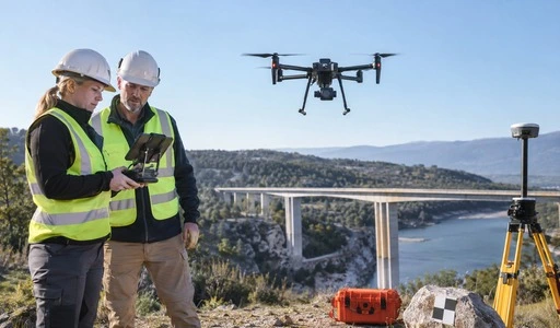
Purchasing and Integrating UAV Technology: A B2B Buyer's Guide
Evaluating Platforms, Training, and Total Cost of Ownership
When companies buy UAV applications technology solutions, they have to think about more than just the specs of the aircraft. This is true whether the solutions will be used internally or to help create new courses. The total cost of ownership includes the infrastructure for training, the licensing of software, the shipping of spare parts, and the ongoing costs of keeping a certified flight crew.
Each of the top sites serves a different group of customers. With its flexible payload systems and large developer SDK environment, DJI is the leader in commercial agriculture and inspection. senseFly makes high-precision fixed-wing devices for expert geospatial mapping. With a focus on industrial materials and roofs, Kespry provides a fully integrated cloud-based work flow. Depending on the tactical situation, each platform has useful strengths. So, procurement teams shouldn't just look at name recognition when making decisions; they should also look at specific mission profiles.
The most important investment in buying is in the skills of the people who will be using the hardware. Building up certified technical talent in-house helps companies rely less on outside contractors, make sure data quality is consistent, and meet project needs more quickly. This is exactly what the UAV applications technology program at ECR Academy offers: a structured, industry-aligned curriculum created by enterprise drone engineers and academic experts; along with four dedicated training labs that cover simulation, assembly, maintenance, and field operations.
Conclusion
Drone technology is no longer just an idea; it is now measurable, scalable, and strategically important for agricultural, mapping, and infrastructural inspection. Businesses and schools that put structured technical education ahead of buying equipment are in the best position to get the most out of their drone investments. The UAV applications technology program at ECR Academy is a tough, industry-recognized way to become a qualified worker in the field of modern drone operations.
Frequently Asked Questions
1. Do learners need prior drone experience to enroll in ECR Academy's program?
There is no need for previous training. The first part of the program covers basic topics like flight rules, mechanical drawing, and electrical systems. Next, students move on to more advanced flight operations and real-world uses. To be successful, you don't have to know a lot about physics or be good at doing technical work by hand.
2. What career roles does the program prepare graduates for?
Aerial Survey Data Processing Specialist, Inspection Operations Technician, UAV applications technology specialist, and UAV Pilot are some of the jobs that graduates are ready for. These jobs are a direct match for people who want to work in public safety, energy inspection, agriculture, and surveying.
3. How are the training platforms structured?
There are four labs that work together at ECR Academy. They are a Flight Training Lab, an Inspection and Maintenance Lab, a Simulation and Virtual Training Lab, and an Assembly and Debugging Lab. These platforms create a closed-loop technical system that takes students from basic building to using these skills in the real world.
4. Can enterprises partner with ECR Academy to build custom pilot training programs?
Yes, the ECR Academy works closely with businesses, trade schools, and industry groups to create training programs that are specifically designed for tasks like spraying crops, mapping geospatially, and inspecting power lines.
Partner with ECR Academy for Industry-Ready UAV Talent Development
ECR Academy is a reliable company that teaches UAV applications technology. They have been teaching professional skills in 28 countries for 16 years. Our UAV applications technology program uses four specialized training platforms, project-based learning, and instructors who are approved by the industry to make sure that graduates can meet real operational needs, such as those in precision agriculture and infrastructure inspection. Get in touch with our team right away to talk about a custom training partnership. Visit enteredu.com or reach us directly at ecr2008@enteredu.com.
References
1. Federal Aviation Administration. FAA Aerospace Forecast: Fiscal Years 2023–2043. FAA, 2023.
2. American Society of Agricultural and Biological Engineers. Unmanned Aerial Systems in Precision Agriculture. ASABE, 2022.
3. Colomina, I., & Molina, P. "Unmanned Aerial Systems for Photogrammetry and Remote Sensing: A Review." ISPRS Journal of Photogrammetry and Remote Sensing, 2014.
4. North American Electric Reliability Corporation. Transmission Vegetation Management Standard FAC-003. NERC, 2022.
5. Nex, F., & Remondino, F. "UAV for 3D Mapping Applications: A Review." Applied Geomatics, 2014.
6. Watts, A. C., Ambrosia, V. G., & Hinkley, E. A. "Unmanned Aircraft Systems in Remote Sensing and Scientific Research." Remote Sensing, 2012.

_1781601799781.webp)